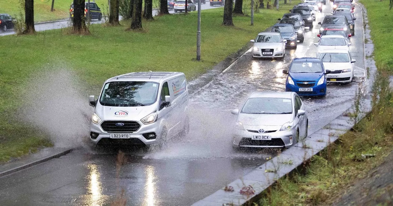
The AA has issued an urgent warning to all drivers ahead of the arrival of Storm Éowyn, the first named storm of 2025. The Met Office has issued a severe amber warning for parts of the UK, predicting strong winds of up to 90mph. Drivers are advised to check forecasts, adjust their speed, and consider if their journey is necessary.
The AA has issued an urgent warning to all drivers ahead of the arrival of Storm Éowyn, the first named storm of 2025. The Met Office has issued a number of alerts covering much of the UK, including a severe amber warning for Northern Ireland, southern Scotland, northern England, and North Wales, for strong winds on Friday (January 24). Gusts of 80-90mph are expected in some areas, particularly at the coast, with 50-65mph gusts predicted throughout Friday and into the early hours of Saturday.
Road, rail, air, and ferry services are likely to be severely affected, with longer journey times and cancellations possible. Some roads and bridges are expected to close. The AA is now advising drivers to check forecasts before venturing out and to adjust their speed to suit the conditions. In the most affected areas, drivers are asked to 'consider if their journey is necessary' and stick to main roads where possible. The exact track of the storm is still unclear, but it’s expected to affect a wide area of the UK including Scotland, northern England, the Midlands, and Wales, before moving off in a north easterly direction. The AA said that strong gusts of wind can unsettle vehicles, so drivers should 'maintain a firm grip of the steering wheel with both hands.' Chris Wood, AA Patrol of the Year, said: “First and foremost drivers should consider if their journey is necessary or consider waiting until the storm has passed. If you need to travel, choose main roads if you can, as these are less likely to be exposed to fallen branches and debris. “When driving in high winds keep both hands on the steering wheel and reduce your speed. Essential advice for driving in adverse weather conditions can be found on The AA website. “Keep an eye out for gaps between trees, buildings or bridges over a river or railway – these are some of the places you are more likely to be exposed to side winds. Ensure that you maintain enough room either side of your vehicle so you can account for it being blown sideways, use extra caution if passing those on two wheels. “Allow extra time, as it’s likely your journey will take longer than usual, and ensure you have plenty of fuel or electrical charge if driving an electric vehicle (EV). Ensure your mobile phone is fully charged and download the AA app and what3words to help us get to you faster if the worst should happen.
STORMEOWYN AA WARNING UK WEATHER STRONG WINDS TRAVEL ADVICE
United Kingdom Latest News, United Kingdom Headlines
Similar News:You can also read news stories similar to this one that we have collected from other news sources.
 First named storm of 2025, Storm Eowyn, set to hit UKThe first named storm of 2025, Storm Eowyn, is expected to bring rain and heavy winds to the UK this weekend. This is the fifth named storm of the 2024-25 storm season, following Storms Ashley, Bert, Conall, and Darragh. The Met Office has issued warnings and advises people to be prepared for potential disruptions.
Read more »
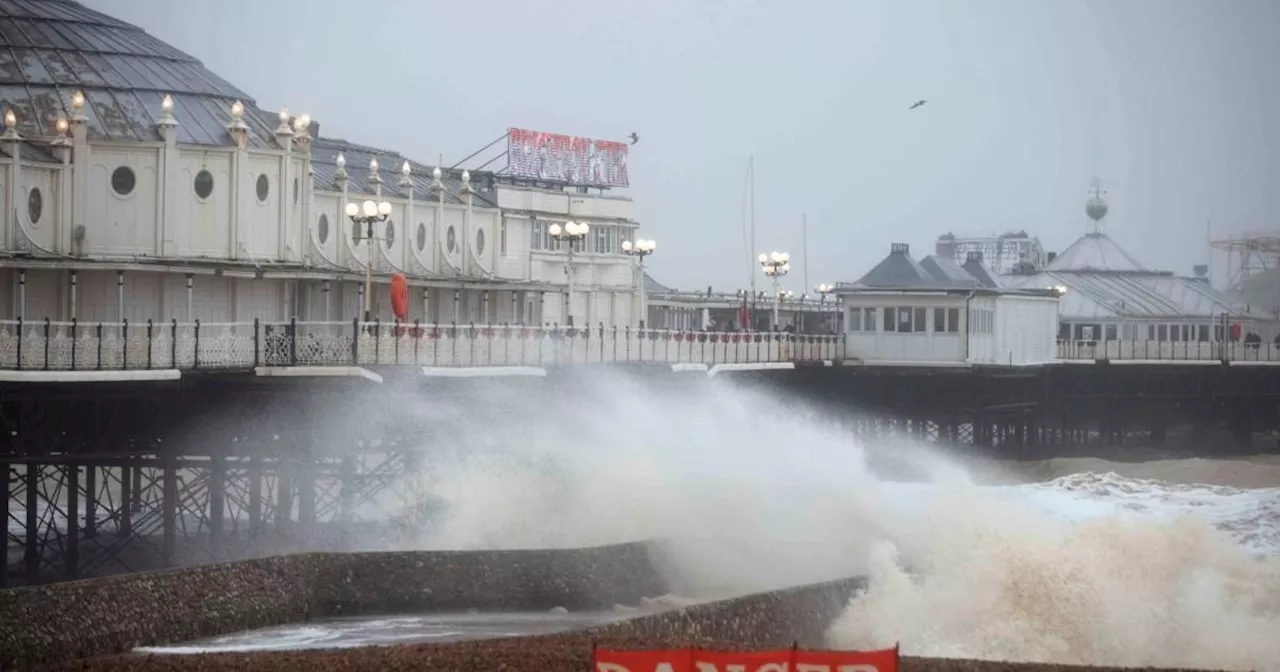
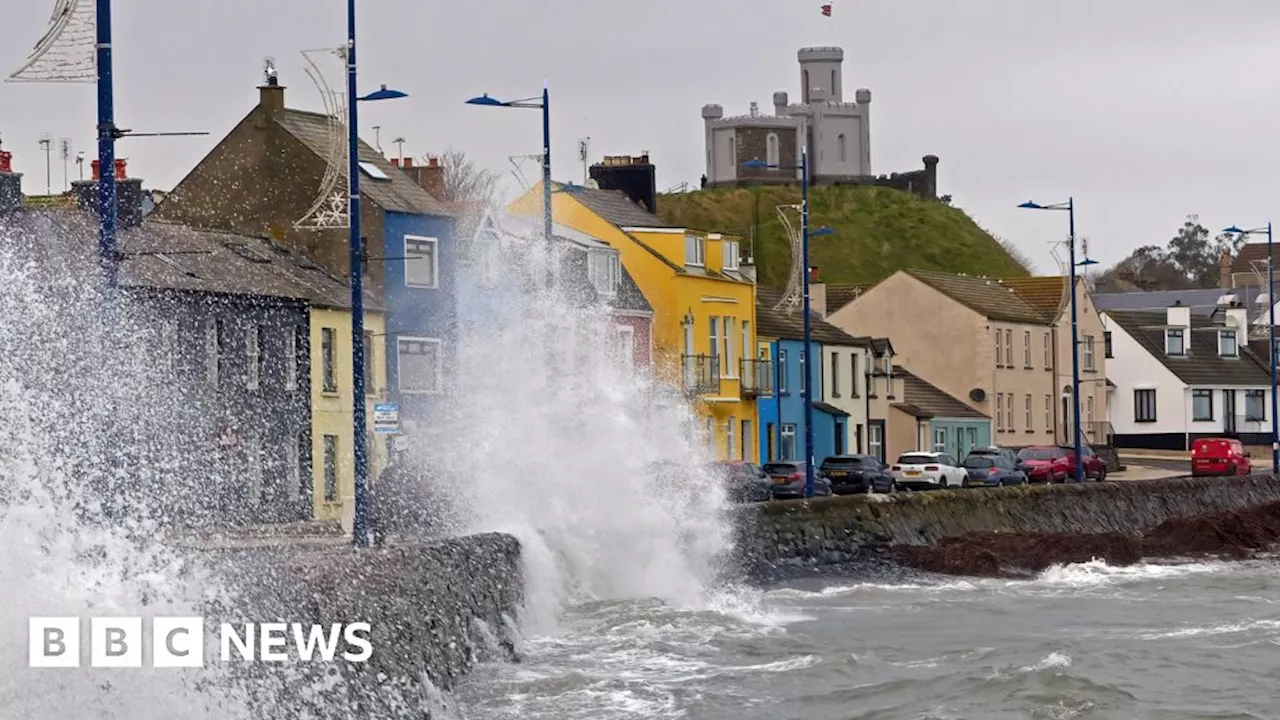
 Storm Eowyn: Amber Weather Warnings Issued as Storm Batters UK and IrelandThe UK is bracing for the impact of Storm Eowyn, with amber weather warnings issued for parts of Northern England, North Wales, Northern Ireland, and Southern Scotland, predicting wind gusts of up to 70mph inland and 90mph on coasts. Yellow warnings cover the entire UK for Thursday, with high winds anticipated. Met Eireann, Ireland's meteorological service, issued a rare red warning for counties Limerick, Clare, Cork, and Kerry, warning of 'severe, damaging and destructive gusts' reaching up to 120mph.
Read more »
 Storm Eowyn: Amber Wind Warning Issued for Most of ScotlandStorm Eowyn, a powerful weather system, is set to bring high winds and disruptive weather to Scotland on Friday. The Met Office has upgraded the wind warning from yellow to amber for much of the country, with gusts potentially reaching up to 90mph. The amber warning, in effect from 06:00 to 21:00 on Friday, covers several regions including Central Scotland, Tayside & Fife, Grampian, Highlands & Eilean Siar, South West Scotland, Lothian & Borders, and Strathclyde. A separate yellow warning is in place for Saturday, impacting all of Scotland with winds of up to 60mph inland and 70mph near the coast.
Read more »
 Storm Éowyn Brings Potential Danger to Ireland and UKStorm Éowyn is set to batter Ireland and the UK with high winds and potential for damage, prompting multiple warnings from meteorological agencies.
Read more »
 Storm Eowyn to Bring 'Danger to Life' Winds and Widespread Disruption to UK and IrelandStorm Eowyn is set to batter the UK and Ireland with dangerous winds, bringing the risk of 'a danger to life' due to flying debris. Amber and red wind warnings have been issued, with forecasters predicting gusts of up to 130kmh in Ireland and 90mph in exposed areas of the UK. The storm is expected to cause widespread disruption, including fallen trees, power outages, travel chaos and coastal flooding.
Read more »
 Met Office issues Storm Éowyn warning amid 60mph winds and heavy rainPeople have been told to plan ahead and take precautions
Read more »