
May is one of our most severe months of the year, but it also brings a lot more daylight and warm weather.
The jet stream will park across the Midwest next week, swinging multiple rounds of rain and storms toward Indiana. 1-3 inches will be possible by next weekend.INDIANA, USA — The first full week of May 6-10 looks active across Indiana, with multiple rounds of rain and storms, some of them severe. The jet stream will park in the Corn Belt and Midwest, helping to sling many waves of downpours toward Indiana. The best chances for severe weather may be Tuesday night and Wednesday night.
The morning should trend drier, with more rain and scattered storms in the evening and overnight hours. Some of these may turn severe. There is an early severe zone from the Storm Prediction Center over Indiana.It will not rain all day, in fact the first half of the day looks really nice. Watch for storm threats later.We may start the day with some scattered showers, especially if the storms the night before linger for a while across Indiana.
Later in the afternoon, evening and overnight hours, more scattered storms are likely to develop. These may also turn severe. Depending on how much we recover, storm threats may shift a bit farther south.By Thursday the jet stream should push east, allowing some cooler air to move in. However we may remain unsettled for a few days with scattered showers and some downpours. Some of the rain may be enhanced by Lake Michigan.
This showery weather will be most likely during the middle of the day as we warm temperatures up. Warmer air allows more instability to create these scattered showers. Timing will likely change over time, but the general premise remains. Watch for on-and-off scattered rain and storms. Severe threats are possible with wind, hail, and tornadoes, especially Tuesday and Wednesday. In between rain chances, you may get some nice weather. Bits of sun and warmer air will nestle in between the storms.
United Kingdom Latest News, United Kingdom Headlines
Similar News:You can also read news stories similar to this one that we have collected from other news sources.
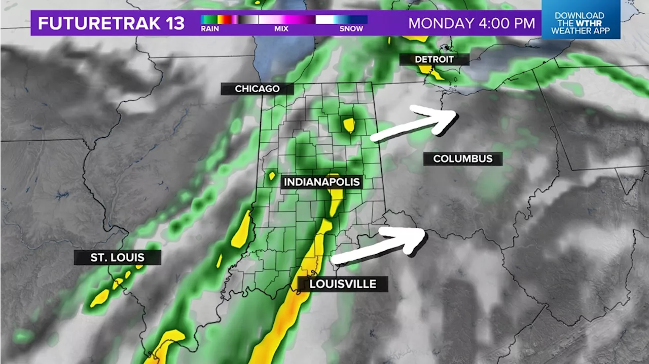 Storm zone heading east to Indiana by Monday | Live Doppler 13 Weather Blog13News meteorologist Matt Standridge is taking a look at the storm possibilities for central Indiana.
Read more »
 Tropical return to central Indiana | Live Doppler 13 Weather BlogIt looks like Indiana has a rainy week ahead.
Read more »
 Big warm-up on the way for Indiana this weekend | Live Doppler 13 Weather BlogWe won't see any more rain today, but the breeze will keep us unseasonably cool all day long.
Read more »
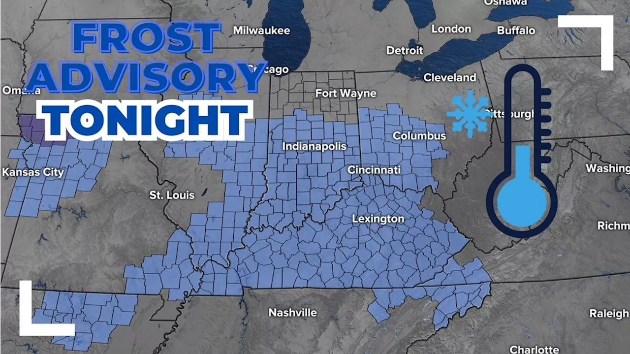 Frost Advisory issued for central Indiana | Live Doppler 13 Weather BlogCooler temperatures and rain chances are back in the forecast this week for central Indiana.
Read more »
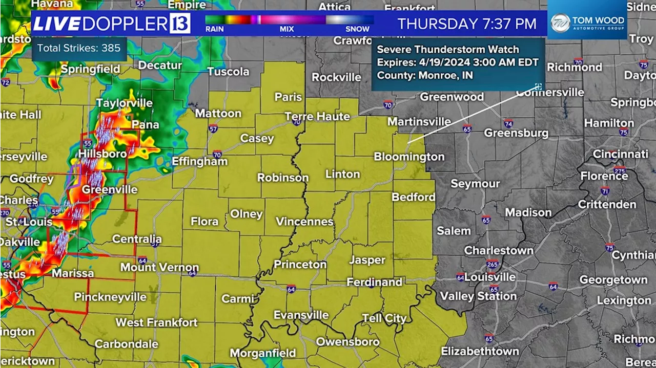 Severe Thunderstorm Watch issued for southwestern Indiana | Live Doppler 13 Weather Blog13News meteorologist Sean Ash is helping you stay weather aware as he's tracking weekend storms in central Indiana.
Read more »
 Rain timeline & storm threat today | Live Doppler 13 Weather BlogLindsey's morning forecast for Monday, April 29, 2024.
Read more »