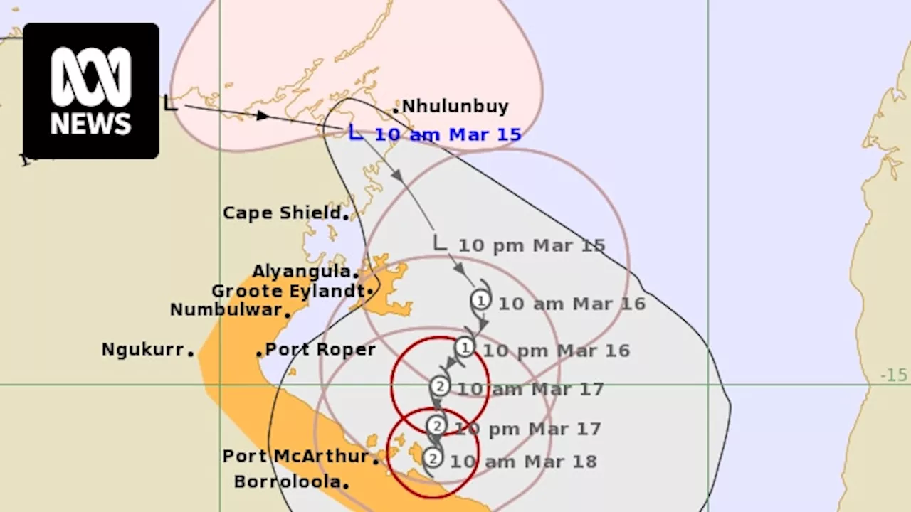
The BOM issues a cyclone watch for coastal communities in the Gulf of Carpentaria from Groote Eylandt down to the NT-Queensland border, as it forecasts a tropical low to strengthen into a cyclone in the Gulf tomorrow.
The BOM says a tropical low is forecast to develop into a cyclone on Saturday morning in the Gulf of Carpentaria.A tropical cyclone is expected to develop on Saturday in the Gulf of Carpentaria, with the Bureau of Meteorology issuing a cyclone watch for coastal communities from Groote Eylandt down to the Northern Territory-Queensland border.
"It has moved quite quickly overnight across the northern coast of the Top End and is expected to move into the Gulf of Carpentaria over the next 24 hours."The tropical low is predicted to bring strong winds and heavy rain to the region, particularly to the south-western Gulf coast. "Gales with damaging wind gusts of 100 kilometres per hour may extend further to the Northern Territory coast between Alyangula to the Northern Territory/Queensland border, including Borroloola, from as early as Saturday evening, though more likely during Sunday," the BOM said.
"That system expected to move southwards through potentially the Carpentaria district or possibly anywhere along the southern Gulf of Carpentaria coast."The BOM said rainfall totals of up to 147 millimetres had been recorded across a broad flood watch area in the past 24 hours, following several days of heavy falls.