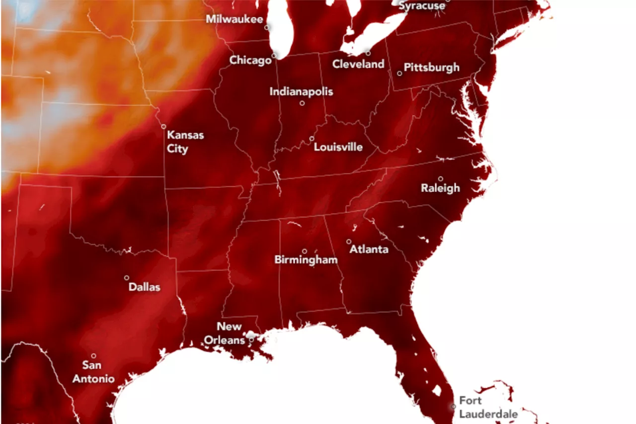
A heat dome over many Midwest and Northeastern states has led to record-breaking high temperatures.
The sweltering temperatures scorching most of the Midwest, Northeast, East Coast and South this week can be seen on a new NASA map.The map was created using satellite observations on Wednesday, with temperatures about 6 feet above the ground predicted by NASA's Goddard Earth Observing System model. The darkest red color on the map indicates that temperatures were 93 degrees F or higher.
With the increasing effects of climate change, heat waves like this one are becoming more and more common: NASA's Goddard Space Flight Center researchers found that between 1980 and 2023, summer heat waves across the U.S. doubled in frequency.'We have warmed up the planet by about 2 degrees Fahrenheit in the last century or so,' Gavin Schmidt, the director of NASA's Goddard Institute for Space Studies, told the NASA Earth Observatory.
United Kingdom Latest News, United Kingdom Headlines
Similar News:You can also read news stories similar to this one that we have collected from other news sources.
NASA-Led Mission to Map Air Pollution Over Both U.S. CoastsThis summer between June 17 and July 2, NASA will fly aircraft over Baltimore, Philadelphia, parts of Virginia, and California to collect data on air
Read more »
 Cosmic Revelations: AI and NASA Swift Map the Universe’s Farthest Gamma-Ray BurstsScience, Space and Technology News 2024
Read more »
 Mass. State Economic Development Secretary Shows Us A Road Map On AIJohn Werner has created a career out of bringing ideas, networks and people together to generate powerful results. John is a Managing Director and Partner at Link Ventures. John's deep curiosity and penchant for problem-solving led him to a diverse set of roles spanning many fields and interests.
Read more »
 South Carolina Map Shows How State Could Be Underwater From Sea Level RiseSea levels rose about 7.1 inches in Charleston between 2010 and 2023—four times the rate of the previous 30 years.
Read more »
 Atlanta Boil Water Map Shows Area Impacted as State of Emergency DeclaredResidents and property owners of areas affected by water main breaks in the city remain under boil water advisories as crews work to repair a pipe.
Read more »
 Washington Map Shows Where State Could Be Underwater From Sea Level RiseAn interactive map shows how Washington's extensive coastal regions could be at risk as sea levels rise due to climate change.
Read more »
