
The rise in temperatures during the week means the next storm will likely bring more of a wintry mix.
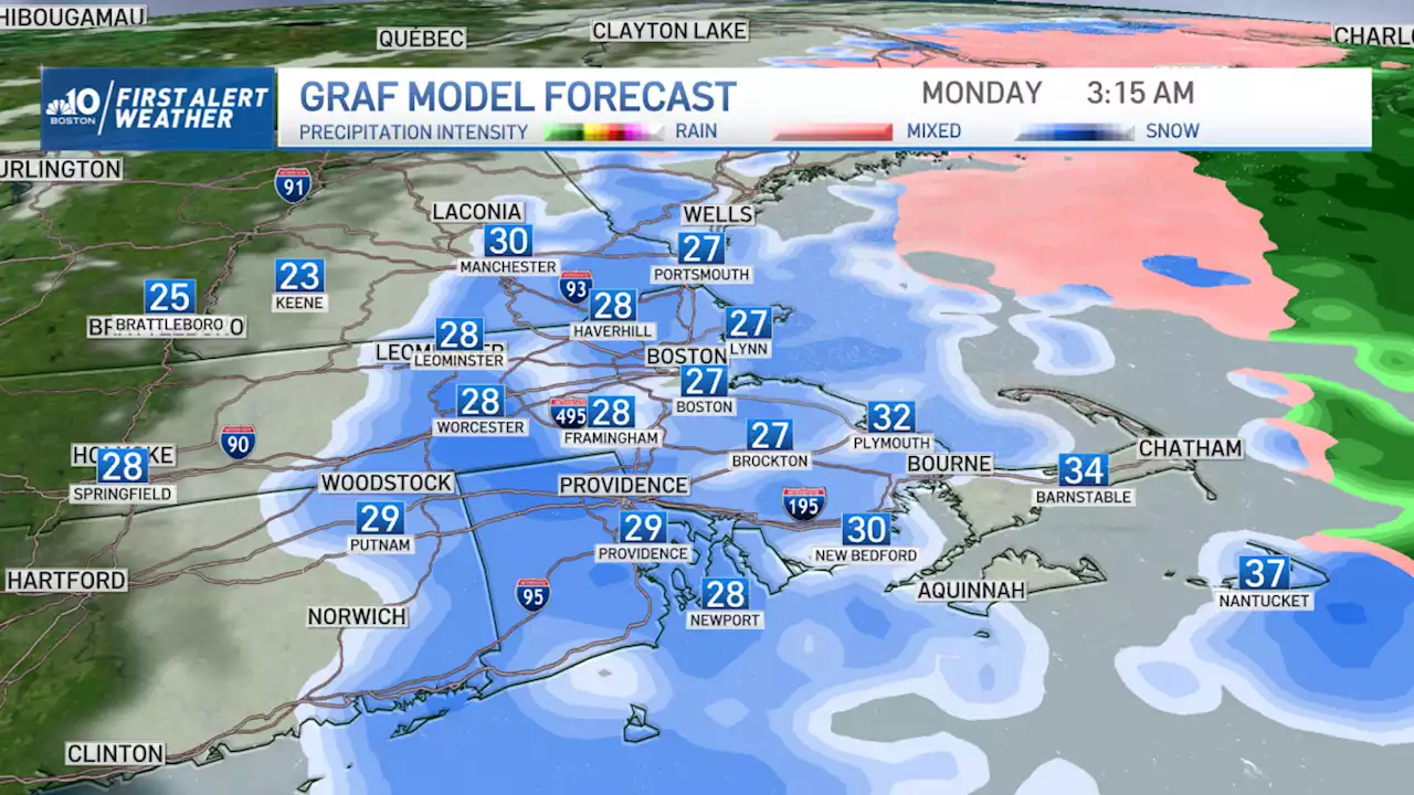
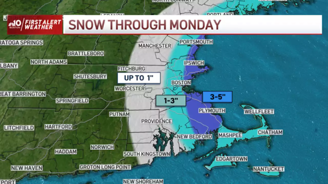
A powerful ocean storm slowly meandering well southeast of New England still bringing some wintry weather to portions of the region this afternoon.
Bands of snow and rain showers continue to come and go across Eastern New England, accumulating a fresh two to four inches in much of Maine over the course of the day, while measuring less farther south but keeping roads wet into the evening and night across Southeastern NH and Eastern MA, where partial clearing after midnight will mean icy spots needing continued road treatment into dawn Tuesday.
Some sunshine Tuesday will be a nice change of pace, helping temperatures to rebound into the 40s for many, 30s Northern New England, before clouds increase late Tuesday and a quick-moving disturbance aloft delivers some scattered late evening and night rain and snow showers of little consequence to New England.
This will make our next storm system – winding up from the Midwest to the Great Lakes Wednesday into Thursday, then redeveloping near Cape Cod Thursday night into Friday – hard pressed to deliver snow to Southern New England, though Ski Country very likely will see accumulating snow Thursday into Friday, with over half of foot expected, and even spots farther south like the Lakes Region of New Hampshire and Southern Maine may get into the accumulating snow zone, as well.
Behind the late week storm, a shot of cool and dry air will start the weekend out on a fair note, though by late Sunday another energetic system approaches, raising the potential for rain south and snow or rain north. One thing that remains consistent in the First Alert 10-day forecast: the absence of deep winter cold in New England, with the chance of more meaningful cold not rising until the final weekend of the month, by the way it looks to our team right now.
United Kingdom Latest News, United Kingdom Headlines
Similar News:You can also read news stories similar to this one that we have collected from other news sources.
 Millie Mackintosh gets ‘new year new hair’ makeover and feels ‘like a new woman’Mum-of-two Millie Mackintosh is kicking off 2023 with a brand new hair colour and cut to feel ‘ready to embrace the year ahead’ – and even her brows got some TLC too
Read more »
 Cloudy Skies, Snow Showers in Southeast New EnglandOn and off snow showers continue for points East throughout the day on Sunday. A steadier snow develops for the Cape, Islands, and South Shore by early evening. Highs in the middle 30’s. Sunday Night is cold, and features snowfall for spots East of I-495. Areas right along the coast and on the Cape could see as much as 2-4”…
Read more »
 What Parts of New England Have Seen the Most Snow?Snow fell across New England Sunday into Monday, but some areas got more than others. The National Weather Service provides snowfall totals. These are some of the highest reported amounts we’ve seen so far: 10:50 pm EST – 1/15/2023 1 NNW COHASSETT, MA 3.310:25 pm EST – 1/15/2023 GORHAM, ME 1.2 12:00am EST – 1/16/2023 2 SSE DUNSTABLE, MA 2.705:00…
Read more »
 FIRST ALERT: Mix of Light and Heavy Snow Bands Continue to Move Through RegionA gnarly, intense, gusty ocean storm is still gripping New England on this MLK Day. We’re on the back side of it, but the forecast remains difficult and somewhat uncertain. Snow bands continue to form and fade through the day. There will be lulls in the snow at times, and as the storm begins to (finally) pull away, we’ll see…
Read more »
 Snow Tapers by Late Afternoon, Temps Rise Turning Snow to SlushThe last couple of weeks, we only seem to get enough cold air into New England for snow when the wind cranks out of the north to carry cold southward from Eastern Canada. Thanks to the nearby ocean storm – a powerful storm still presenting with an eye feature over the Atlantic Ocean Monday morning – we got that northerly…
Read more »
 Another Storm Hits California as More Flooding Is PossibleOn Sunday, showers continued at a rate of half-an-inch per hour
Read more »