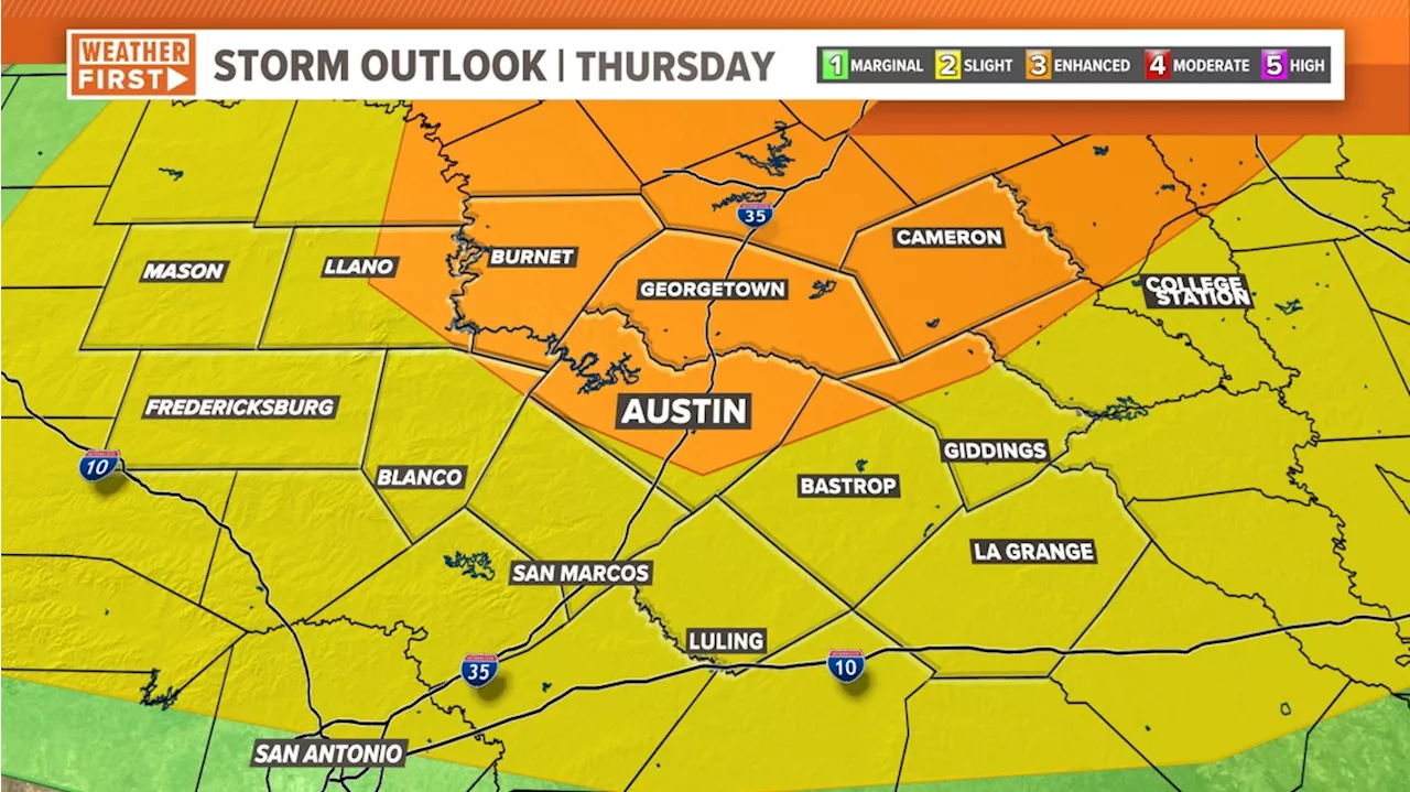
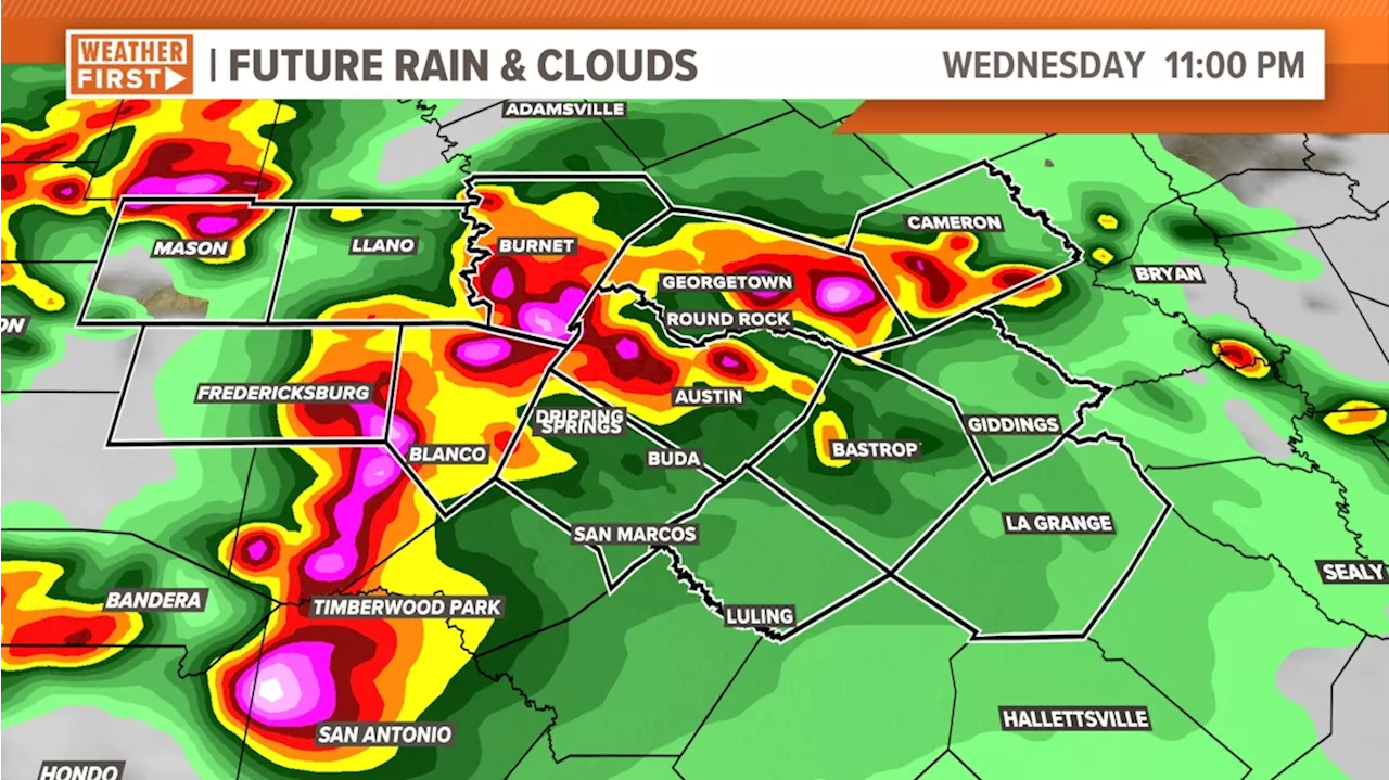
Periods of thunderstorms are likely Wednesday and Thursday. Some storms may be severe.
Drivers move along Interstate 35E in heavy rain on Thursday, March 16, 2023. Much of the Dallas-Fort Worth metroplex was placed under several storm warnings throughout the evening as conditions worsened.There is the potential for a few severe thunderstorms this evening containing large hail and gusty winds. Any storms that develop will dissipate by 11 p.m., followed by dry weather overnight.
Most of us will be waiting until Wednesday and Thursday for more widespread thunderstorms. There is the possibility of severe weather on both days as some of the storms could produce damaging winds and large hail. The tornado risk is low, but not zero. The most active day for storms will likely be Wednesday, with lower storm coverage on Thursday.The Memorial Day weekend looks hot and humid with highs in the low to mid 90s with many dry hours each day.
A chance of a few evening storms, then partly to mostly cloudy and breezy. Low: 75. Wind: S 10-15 mph.Partly to mostly cloudy and very warm with a 70% chance of showers and storms. Some storms may be severe with large hail and damaging winds. High: 88. Wind: S 10-15 mph. Partly sunny and hot with a 20% chance for an isolated storm. Low: 73. High: 93. Wind: S 10-15 mph. Partly sunny and hot with a 20% chance for an isolated storm. Low: 73. High: 94. Wind: S 10-15 mph.
United Kingdom Latest News, United Kingdom Headlines
Similar News:You can also read news stories similar to this one that we have collected from other news sources.
 Severe weather possible in Central Texas beginning Wednesday evening through ThursdayStrong storms more likely Thursday
Read more »
 Timeline: Severe weather risk Wednesday through Thursday morningStrong storms possible Wednesday evening through Thursday morning
Read more »
 Strong to severe storms possible Thursday and Thursday nightMontgomery, Alabama
Read more »
 Severe storms blitz South again after one of the most active tornado periods in US historyAt highest risk for severe storms and tornadoes was a zone stretching from southeast Texas through much of Louisiana and the Gulf Coast regions of Mississippi and Alabama, to the Florida Panhandle, according to the national Storm Prediction Center.
Read more »
 Live Radar: Watching the dry line, today; Storms, with a risk of severe weather, back in the forecastWednesday and Thursday bring concerns for severe weather.
Read more »
 19 First Alert Weather Day Wednesday: Potential for severe storms following summerlike heatTemperatures and humidity are on the rise.
Read more »
