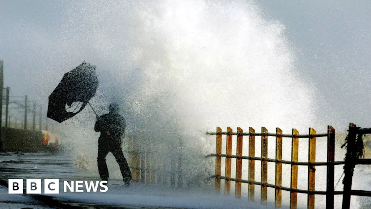
Storm Éowyn, fueled by a powerful jet stream, is set to unleash damaging winds, heavy rain, and hill snow across the UK on Friday. The storm is predicted to be the strongest in years for some regions, prompting travel warnings and school closures. A rare 'danger to life' warning has been issued for Northern Ireland and parts of Scotland, with gusts potentially reaching 100mph. The storm is expected to cause significant disruption to travel, power supplies, and infrastructure.
on Friday, bringing damaging and disruptive winds, along with heavy rain and hill snow in the north. For some parts of the UK, it will not only be the most powerful storm so far this winter, but the strongest storm in years.Ahead of the storm’s arrival, people are being advised not to travel, with transport services suspended and schools closed.
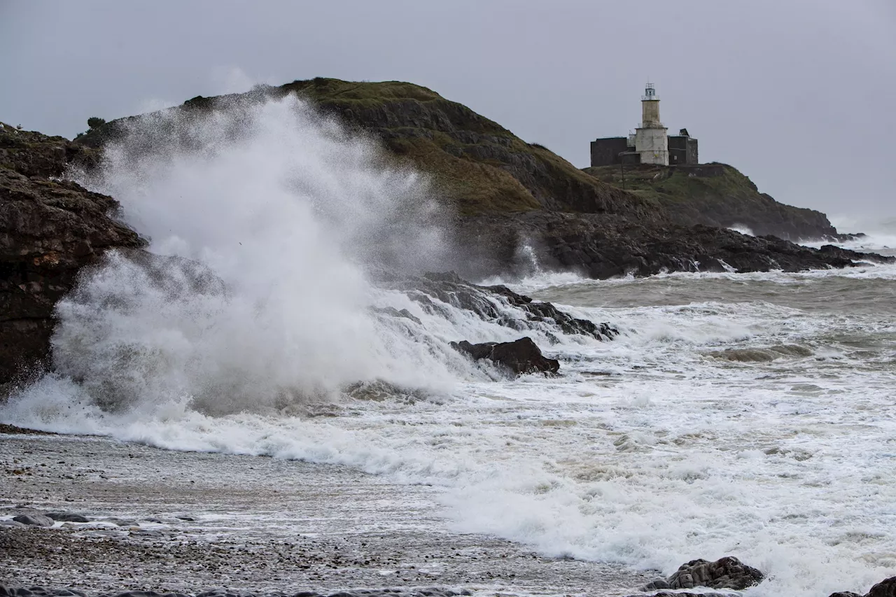
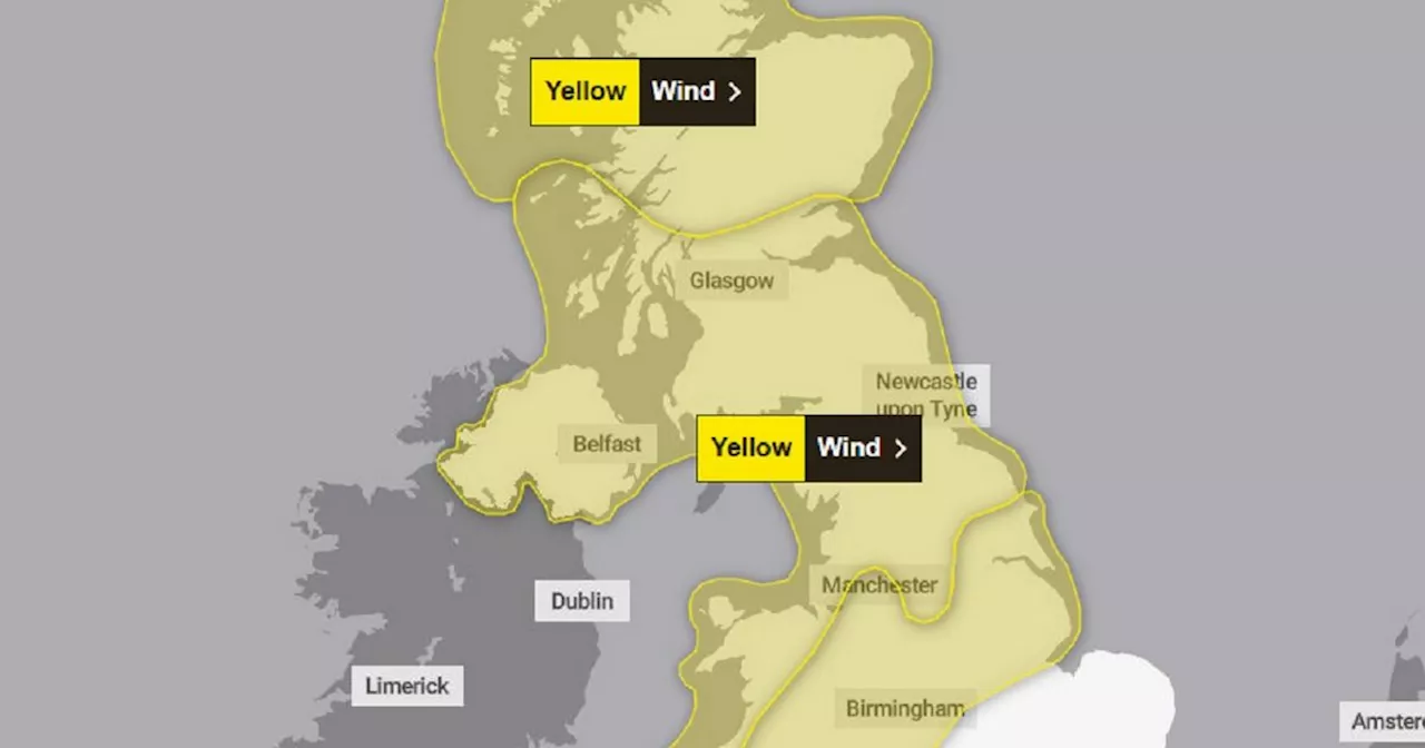
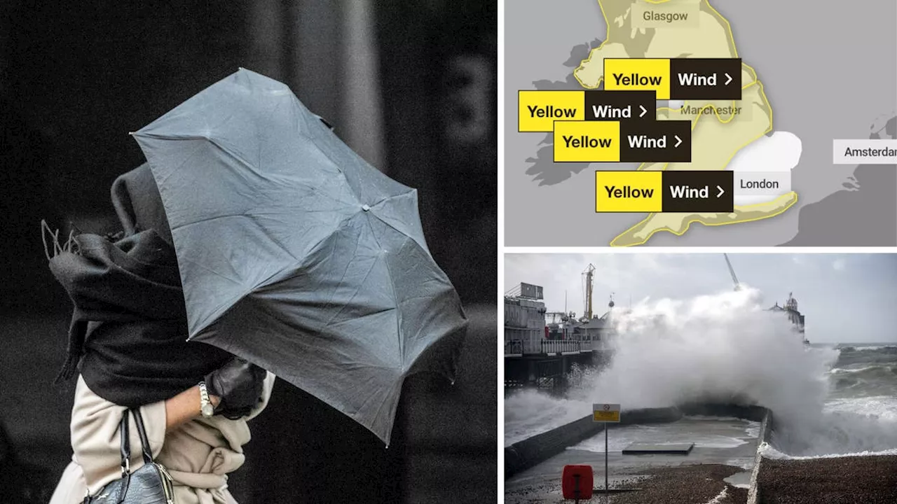
Gusts in these areas are widely expected to reach 80-90mph, with some coasts and hills seeing 100mph. What will make this storm particularly impactful is that it is hitting in the daytime.As well as the red warning, amber and yellow warnings cover the rest of the UK on Friday, where gusts of wind will widely reach 40-70mph, with the strongest winds towards the north and west.Even though the winds won’t be as strong as in the red warning areas, there will still be disruption.
Some snow is likely to fall for a few hours over the hills and mountains in the northern half of the UK, although it is only expected to cause disruption across northern Scotland.The worst of the winds from Storm Éowyn will have cleared Scotland by early on Saturday morning, leaving all parts of the UK with much lighter winds and a mix of sunshine and showers.
STORM WINDS HEAVY RAIN FLOODING UK
United Kingdom Latest News, United Kingdom Headlines
Similar News:You can also read news stories similar to this one that we have collected from other news sources.
 Storm Éowyn officially named as 80mph winds and snow set to batter ScotlandStorm Éowyn is set to hit our shores in the early hours of Friday morning.
Read more »
 Storm Eowyn to Batter Scotland with 90mph Winds, Bringing Danger to LifeThe first named storm of 2025, Storm Eowyn, is set to bring strong winds, up to 90 mph, to Scotland on Friday and Saturday, posing a danger to life from flying debris and large waves. The Met Office has issued yellow weather warnings for high winds across the country, predicting widespread disruption to transport and infrastructure.
Read more »
 Storm Éowyn to Batter UK with 'Very Strong' WindsThe UK braces for the first named storm of 2025, Storm Éowyn, which is set to unleash 'very strong' winds across the country from Thursday night into Friday. The Met Office has issued two yellow weather warnings for wind, covering a significant portion of the UK, with gusts potentially reaching 90mph in some areas. The warnings highlight the potential for widespread disruption, including road closures, power outages, and damage to property.
Read more »
 Storm Éowyn named by Met Office as 80mph winds set to batter the UK this weekendStorm Éowyn is set to bring winds of up to 80mph across the UK on Friday and Saturday, the Met Office has warned.
Read more »
 Storm Éowyn to Batter UK with 80mph Winds, Bringing Travel Chaos and Potential DangerThe UK braces for Storm Éowyn, the fifth named storm of the season, which is set to unleash winds of up to 80mph across the country. The Met Office has issued severe weather warnings with potential for building damage, flying debris, power cuts, and travel disruption. Coastal residents are warned of large waves posing a risk to life.
Read more »
 Storm Éowyn to Batter UK with 80mph Winds and Travel ChaosStorm Éowyn, the fifth named storm of the season, is set to bring strong winds, travel disruption, and potential coastal dangers to the UK.
Read more »