
Tropical Storm Khanun enters PAR, now named FalconPH
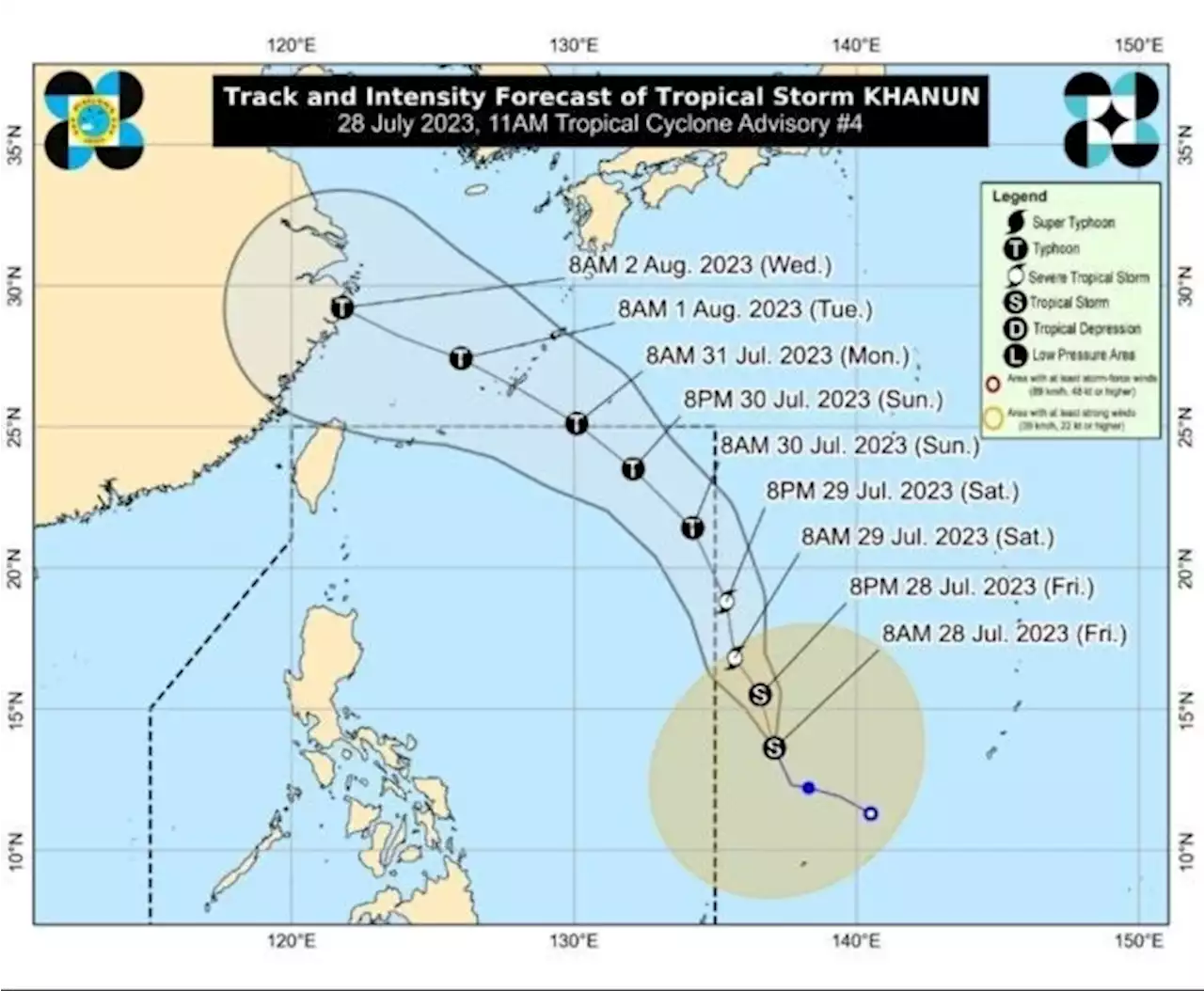
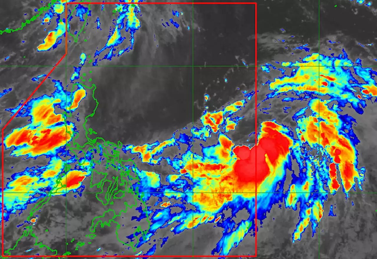
Tropical Storm Khanun entered the Philippine Area of Responsibility early Saturday morning, PAGASA has reported., the tropical storm was reportedly packing maximum sustained winds of 65 kilometers per hour near the center, gustiness of up to 80 km/h, and central pressure of 998 hPa.
The storm is moving north northwestward at the speed of 20 km/h with strong to gale-force winds extend outwards up to 650 km from the center. The tropical storm is forecast to continuously intensify within the next 5 days and become a typhoon on Sunday within the PAR and reach its peak intensity by Tuesday while over the East China Sea or outside the PAR.
United Kingdom Latest News, United Kingdom Headlines
Similar News:You can also read news stories similar to this one that we have collected from other news sources.
 Tropical depression outside PAR now Tropical Storm Khanun; more monsoon rain seenWeatherAlert: The tropical storm with the international name Khanun has maximum sustained winds of 65 km/h early Friday, July 28.
Read more »
 Tropical Storm Khanun to enter PAR in next few hoursTropical storm Khanun maintains its strength and is approaching the Philippine Area of Responsibility (PAR), PAGASA reported.
Read more »
 Tropical storm Khanun maintains strength, still outside PARThe tropical storm outside the Philippine area of responsibility (PAR) is keeping its strength as it accelerates north-northwestward, the state weather bureau reported on Friday. At 11 a.m., the
Read more »
 Tropical Storm Khanun maintains strength as it approaches PARWeatherAlert: Once Tropical Storm Khanun enters the Philippine Area of Responsibility, it will be given the local name Falcon.
Read more »
 Tropical depression intensifies into tropical storm, may enter PAR on SaturdayThe tropical depression outside the Philippine Area of Responsibility has intensified into a tropical storm and will be named "Falcon" once inside PAR, PAGASA reported.
Read more »