
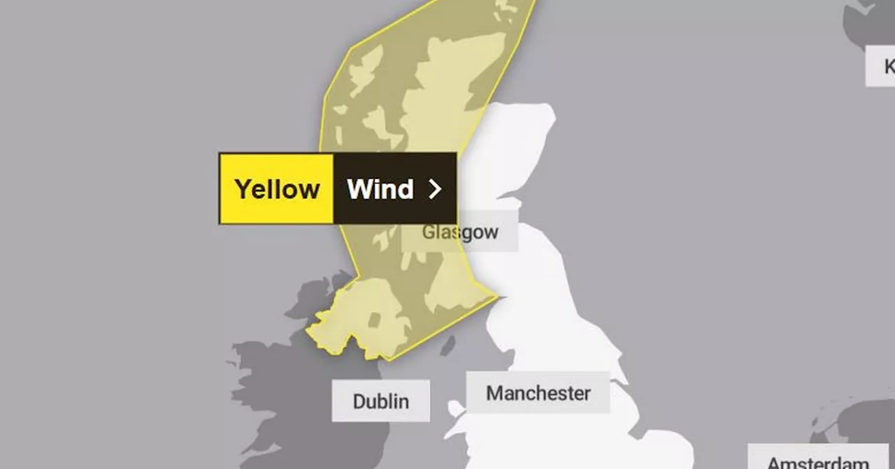
The Met Office has issued a yellow warning for wind as a 'very powerful' weather system, with winds of up to 80mph, is set to hit the UK this weekend.
The Met Office has issued a weather warning as a 'very powerful' weather system approaches the UK, bringing with it 'disruptive' weather conditions and wind gusts of up to 80mph. Overnight on Thursday, a 'very deep' area of low pressure is expected to intensify as it traverses the Atlantic and heads towards the UK, resulting in strong winds and heavy rain fall, according to the Met Office .
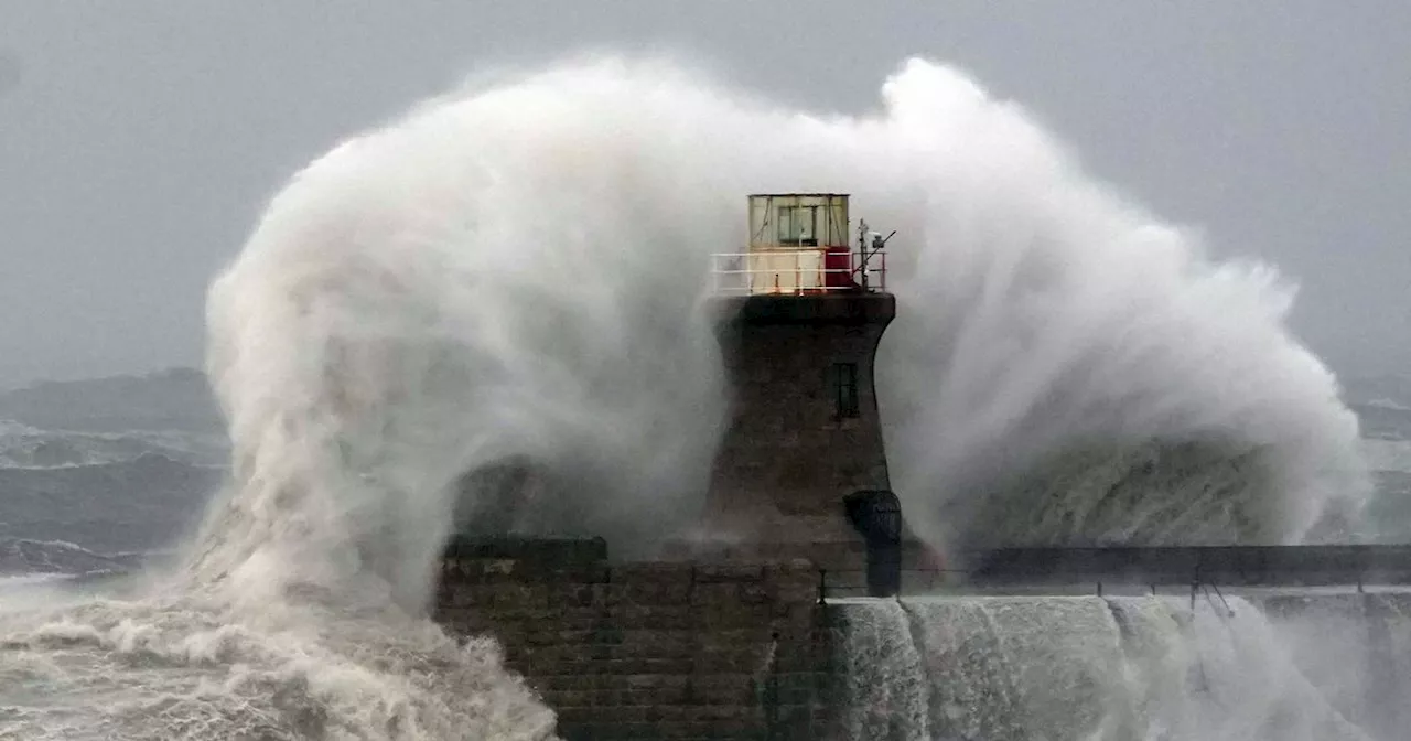
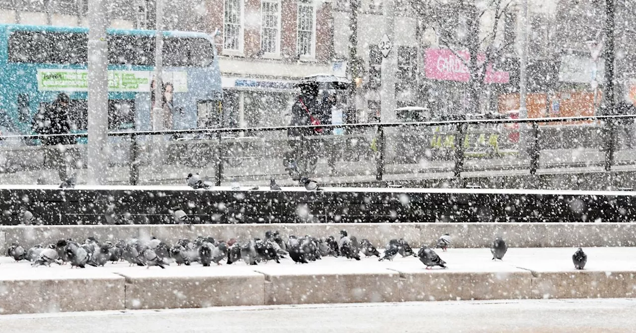
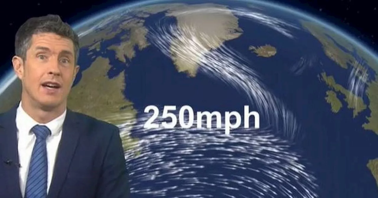
\On Friday, the most intense winds are anticipated across Northern Ireland and western Scotland, where gusts could reach 80mph or exceed that in coastal areas. The Met Office has issued a yellow weather warning for these regions, which will remain in effect until Saturday morning. \In the Met Office's latest video forecast, meteorologist Jonathan Vautrey explained that a 'very powerful jet stream' will amplify the area of low pressure, causing it to deepen rapidly as it travels across the Atlantic. 'By Thursday, we observe numerous isobars developing on the chart, indicating it is a very deep and very powerful system,' he stated. 'It will continue to move towards us as we head into Friday, bringing some very strong winds, heavy rain, and also some snow at times.' The Met Office stated that the weather system could bring the 'strongest winds of the winter so far' and some 'potentially disruptive weather.' It mentioned that 'severe gales' are possible in the western UK. The yellow weather warning for wind encompasses west Scotland and Northern Ireland and will be in effect from midnight on Friday until midday on Saturday. The weather warning states: 'A deep area of low pressure is expected to pass close to or across the northwest of the UK on Friday and Saturday. It will bring a spell of very strong southeasterly to southwesterly winds with gusts reaching 50 to 60mph inland and 70 to 80mph along coasts (and perhaps higher than this in a few locations). The wind strength will gradually ease through Saturday from the south.' \Met Office deputy chief meteorologist Chris Almond added: 'A very deep area of low pressure will bring a very unsettled, potentially disruptive, spell of weather to the UK through Friday and into Saturday. Winds will begin to strengthen on Thursday night with the peak gusts forecast through Friday in Northern Ireland and western Scotland. The wind will also be accompanied by heavy rain bringing some unpleasant conditions to end the week. 'We have issued a Yellow weather warning for wind, and with several days before the impactful weather, the forecast details are likely to be fine-tuned during the week, so stay tuned to your local forecast and keep up to date with Met Office warnings.' \This change in weather coincides with the United States experiencing a severe cold weather spell. A large, very cold pool of air over North America is generating a stark contrast in temperatures across the continent. This contrast is expected to strengthen the jet stream, with jet stream winds reaching up to 250mph, resulting in the deep low pressure over the UK. Mr. Almond explained: 'As the low develops over the Atlantic and interacts with the jet stream, it will rapidly strengthen, a phenomenon called ‘explosive cyclogenesis’, where the central pressure of a low at latitudes in which the UK lies drops 24 millibars or more in 24 hours. This is forecast to happen on Thursday while the system is out over the Atlantic, and it will be a mature feature by the time it reaches the UK.' When a low pressure system undergoes explosive cyclogenesis, it is referred to as a 'weather bomb.' Weather bombs can bring winds that peak over a period of a few hours and can be strong enough to bring down trees and cause structural damage, according to the Met Office. Forecasters have indicated that the wet and windy conditions may persist throughout the remainder of January and into February. \In its long-range forecast for Friday, January 24, until Sunday, February 2, the Met Office states: 'The transition to much more unsettled conditions will commence on Friday as a deep area of low pressure, which is yet to develop, will be steered towards the UK on a powerful Jet Stream - fueled by the recent cold spell over North America. 'A wet and windy few days are likely, with some snow in the north for a time, and then a continuation of these periods of rain followed by showers, often accompanied by strong winds, looks likely for the rest of the month and the start of February. 'There is the potential for weather warnings or even a named storm at some point. Temperatures at least should recover in most places, ending up a little above average, though admittedly not feeling like it at times.'
Weather Bomb UK Weather Met Office Strong Winds Heavy Rain Yellow Warning Exploding Cyclogenesis Jet Stream
United Kingdom Latest News, United Kingdom Headlines
Similar News:You can also read news stories similar to this one that we have collected from other news sources.
 Full list of areas covered by Met Office warning as 80mph winds to batter UKA yellow weather warning is in place for wind later this week
Read more »
 Met Office New Year warning as 75mph winds 'to hit nine areas'It is set to be a very windy start to 2025 for many people as a yellow weather warning is issued
Read more »
 Met Office Issues New Year's Day Weather Warnings for Snow and Strong WindsHeavy snow and strong winds are expected to hit parts of the UK on New Year's Day, prompting weather warnings from the Met Office. The warnings cover a wide swathe of the country, from Manchester and Sheffield to Leeds, Lancashire, Middlesbrough and the North East. The Met Office urges people to stay updated on the forecast and make necessary adjustments to their plans.
Read more »
 Met Office issues 'be prepared' warning with heavy snow and 75mph winds dueThe Met Office has issued two yellow weather warnings for the Midlands - one for snow and one for wind - and people have been urged to 'be prepared' for the wintry conditions
Read more »
 Met Office warns of 'strongest winds of the winter so far'One forecaster is predicting jet stream winds of 250mph describing it as a 'beast' that will bring an area of low pressure to the UK next weekend
Read more »
 Greater Manchester forecast as Met Office warns UK set for 'strongest winds'Winds of up to 40mph are set to batter the region
Read more »