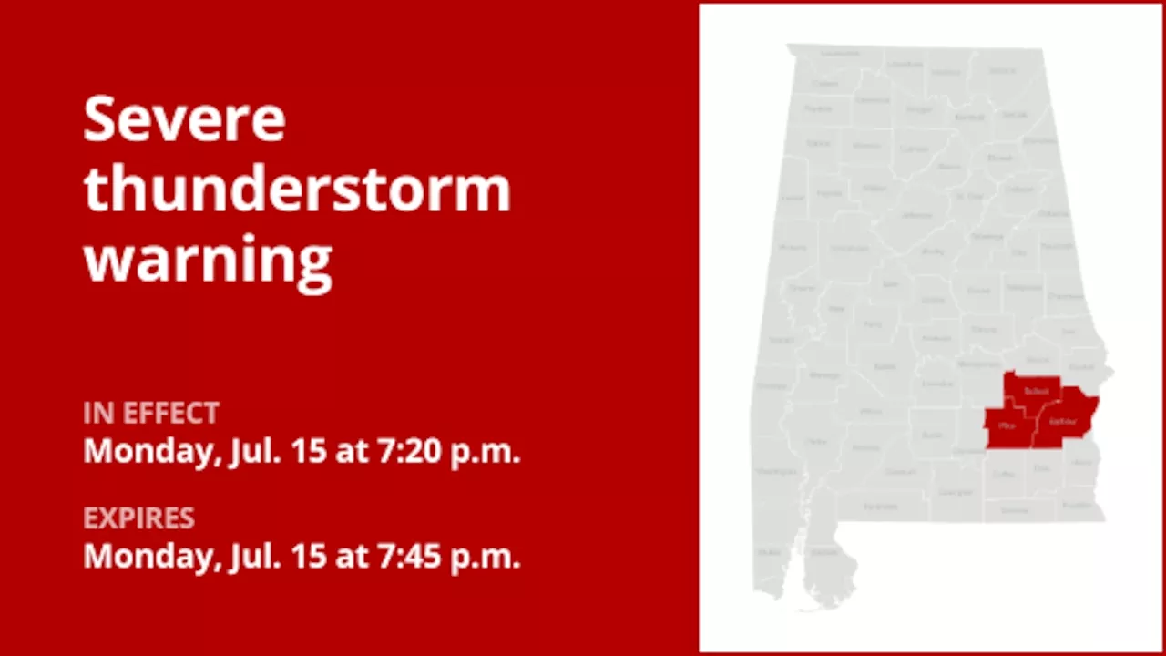
On Monday at 7:20 p.m. an updated severe thunderstorm warning was issued by the National Weather Service valid until 7:45 p.m. for Barbour, Bullock and Pike counties.
Updated: Jul. 15, 2024, 7:29 p.m."At 7:15 p.m., a severe thunderstorm was located over Boot Hill, or 12 miles north of Clio, and is nearly stationary," says the weather service. "Hail damage to vehicles is expected. Expect wind damage to roofs, siding, and trees."
When venturing outdoors, it's vital to establish a clear plan for seeking shelter in case of lightning. It's important to remember that lightning can strike even when a storm seems to have passed, so exercise caution.If you find yourself outdoors without access to indoor shelter during a thunderstorm, take these steps to maximize your safety:Steer clear of tall, isolated trees and other prominent objects. In forested areas, stay close to lower stands of trees.
Do not approach water bodies, wet objects, or metal items. Although water and metal do not attract lightning, they conduct electricity effectively and can pose significant risks.
@Exmeter Weather Alerts @River-State @Exalerts
United Kingdom Latest News, United Kingdom Headlines
Similar News:You can also read news stories similar to this one that we have collected from other news sources.
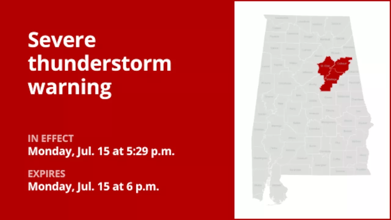 Brace for damaging winds and quarter-sized hail with thunderstorms to hit Central Alabama MondayOn Monday at 5:29 p.m. a severe thunderstorm warning was issued by the National Weather Service valid until 6 p.m. for Calhoun, St. Clair and Talladega counties.
Read more »
 Update: Thunderstorms with damaging winds and quarter-sized hail in Centre and Clinton counties MondayAn updated severe thunderstorm warning was issued by the National Weather Service on Monday at 7:19 p.m. valid until 8:15 p.m. for Centre and Clinton counties.
Read more »
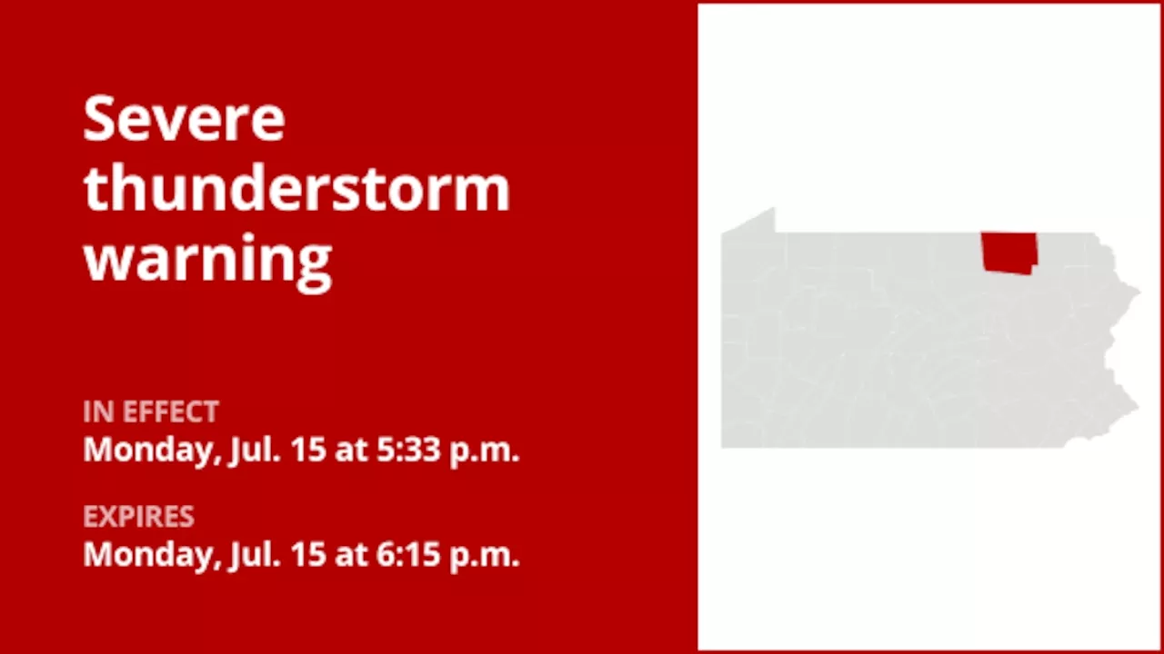 Update: Thunderstorms with damaging winds and quarter-sized hail to hit Bradford County MondayOn Monday at 5:33 p.m. an updated severe thunderstorm warning was issued by the National Weather Service valid until 6:15 p.m. for Bradford County.
Read more »
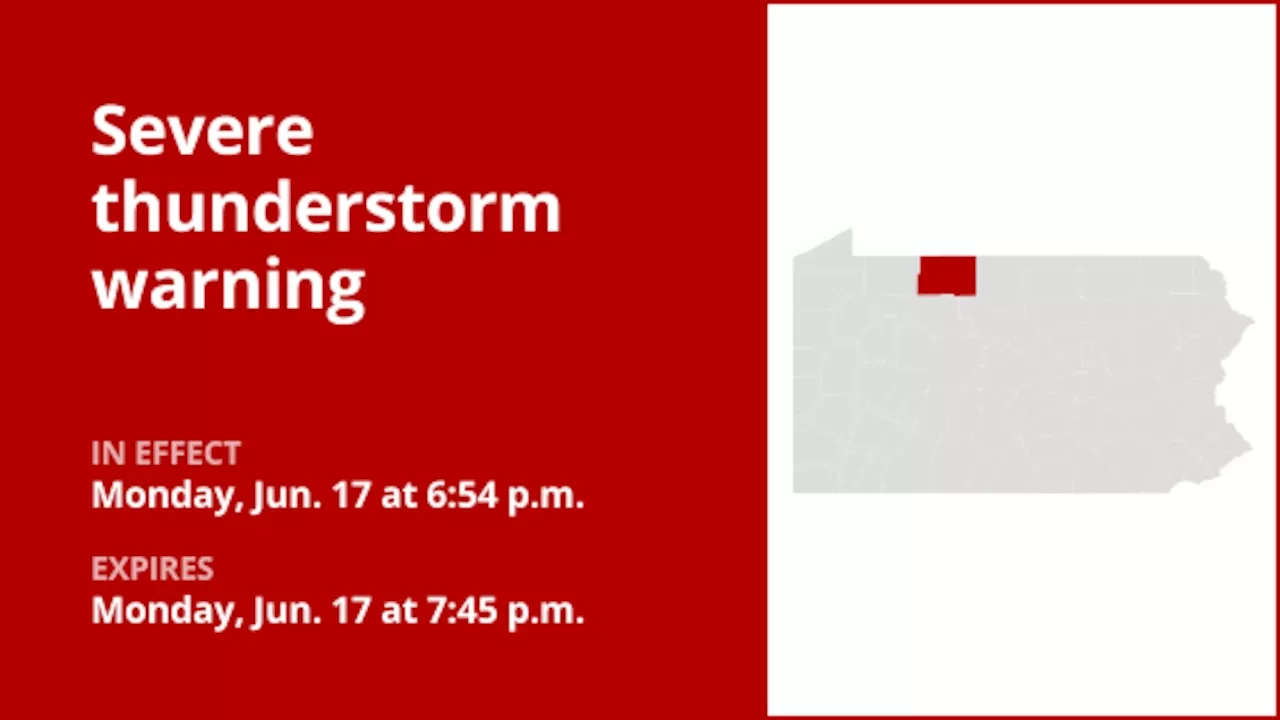 Expect damaging winds and quarter-sized hail with thunderstorms to hit McKean County MondayA severe thunderstorm warning was issued by the National Weather Service on Monday at 6:54 p.m. valid until 7:45 p.m. for McKean County.
Read more »
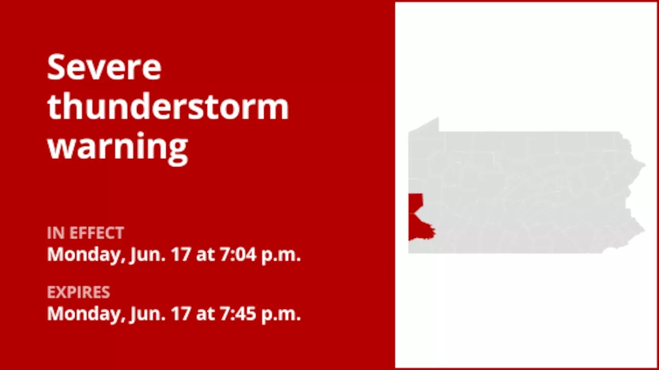 Quarter-sized hail and damaging winds expected with thunderstorms in Beaver and Washington counties MondayOn Monday at 7:04 p.m. the National Weather Service issued a severe thunderstorm warning valid until 7:45 p.m. for Beaver and Washington counties.
Read more »
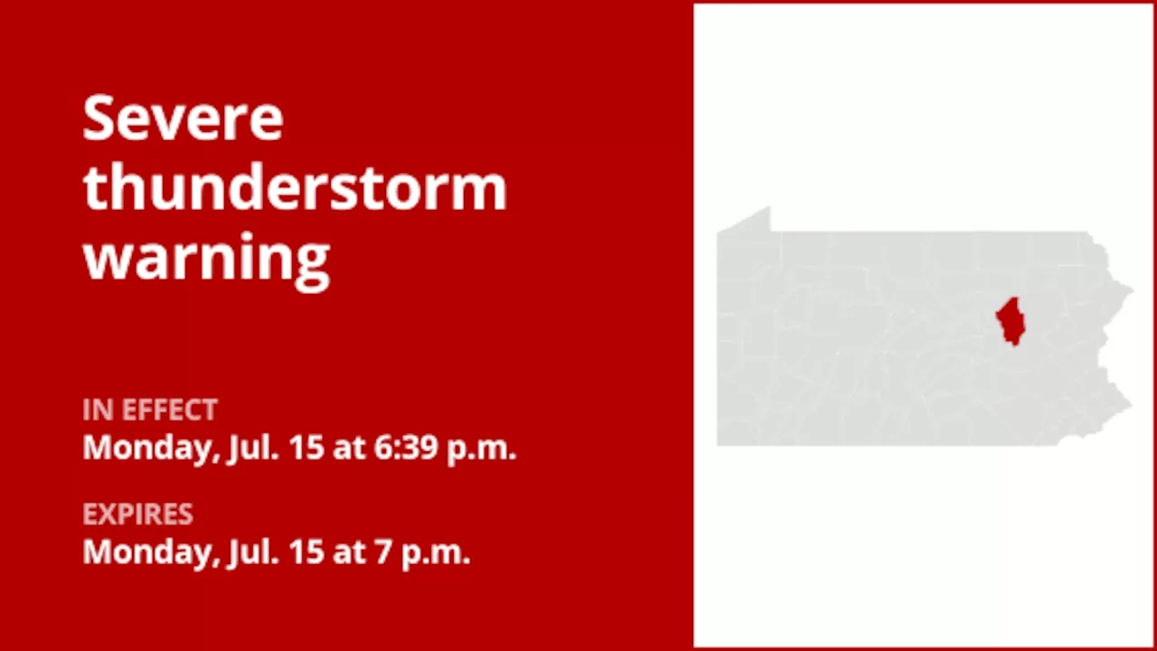 Quarter-sized hail and damaging winds predicted with thunderstorms to hit Columbia County MondayOn Monday at 6:39 p.m. a severe thunderstorm warning was issued by the National Weather Service valid until 7 p.m. for Columbia County.
Read more »