
The Met Office has issued a yellow fog warning for Lancashire, with delays expected to journeys this morning. The warning covers major roads including the M6, M65 and M61. Storm Eowyn, the fifth named storm of the year, is set to bring strong winds to the region later this week, with gusts of more than 80mph possible.
The Met Office has issued a new weather warning for the entire region of Lancashire, anticipating travel disruptions today due to fog. The yellow alert for fog commenced at midnight on January 22nd and remains in effect until 11 am. The warning encompasses major roadways including the M6, M65, and M61, with forecasters predicting that fog patches could lead to some travel disruptions. Drivers and bus passengers are advised to prepare for potential delays.
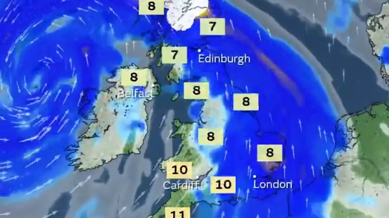
Additionally, flights, including those to and from Manchester Airport, may experience disruptions due to the fog. The Met Office's warning extends to all of Lancashire and surrounding areas such as Greater Manchester, Cheshire, Merseyside, and other parts of the UK. The fog warning states, 'Fog patches are expected to develop overnight and during Wednesday morning before gradually clearing through Wednesday. Fog will bring visibility to below 100m at times, perhaps causing some travel disruption.' It further advises, 'Give yourself the best chance of avoiding delays by checking road conditions if driving, leaving extra journey time, or amending plans if necessary. Make sure you know how to switch on your fog lights, and check they are working before setting off on your journey. Bus and train services, as well as flights and ferry travel may also be affected; check for updates from your travel company and follow their advice.' This weather warning is the latest issued for the region in the coming week. Storm Eowyn, the fifth named storm of the year, is anticipated to bring strong winds to the area later this week. Gusts exceeding 80 mph could result in power outages, travel disruptions, and structural damage as Storm Eowyn threatens the country. There is also a potential danger to life due to flying debris. The UK can expect unsettled conditions to arrive on Thursday (January 23rd), with intensifying winds and heavy rainfall in western parts of the country overnight. Met Office spokesperson Andrea Bishop stated, 'Storm Eowyn will bring a period of very unsettled, potentially disruptive, weather to the UK through Friday and into Saturday. Pronounced ‘Ay-oh-win’, the system will begin to influence the UK’s weather on Friday, with strengthening winds initially in north-western parts of the UK with accompanying heavy rainfall.' Storm Eowyn will bring a spell of strong south-easterly to south-westerly winds, with gusts reaching 50-60 mph inland and 70-80 mph along coasts. Wind strength is expected to gradually decrease from the south throughout Saturday. Met Office deputy chief meteorologist Mike Silverstone remarked, 'The strongest gusts are likely to be felt across parts of Northern Ireland, northern England, north-western Wales, and western Scotland, where exposed sites could get gusts in excess of 80mph, which has the potential to cause impacts for those in these areas. There will also be some heavy rain, bringing some unpleasant conditions to end the week.
WEATHER WARNING FOG STORM EOWYN LANCS TRAVEL DISRUPTIONS STRONG WINDS
United Kingdom Latest News, United Kingdom Headlines
Similar News:You can also read news stories similar to this one that we have collected from other news sources.
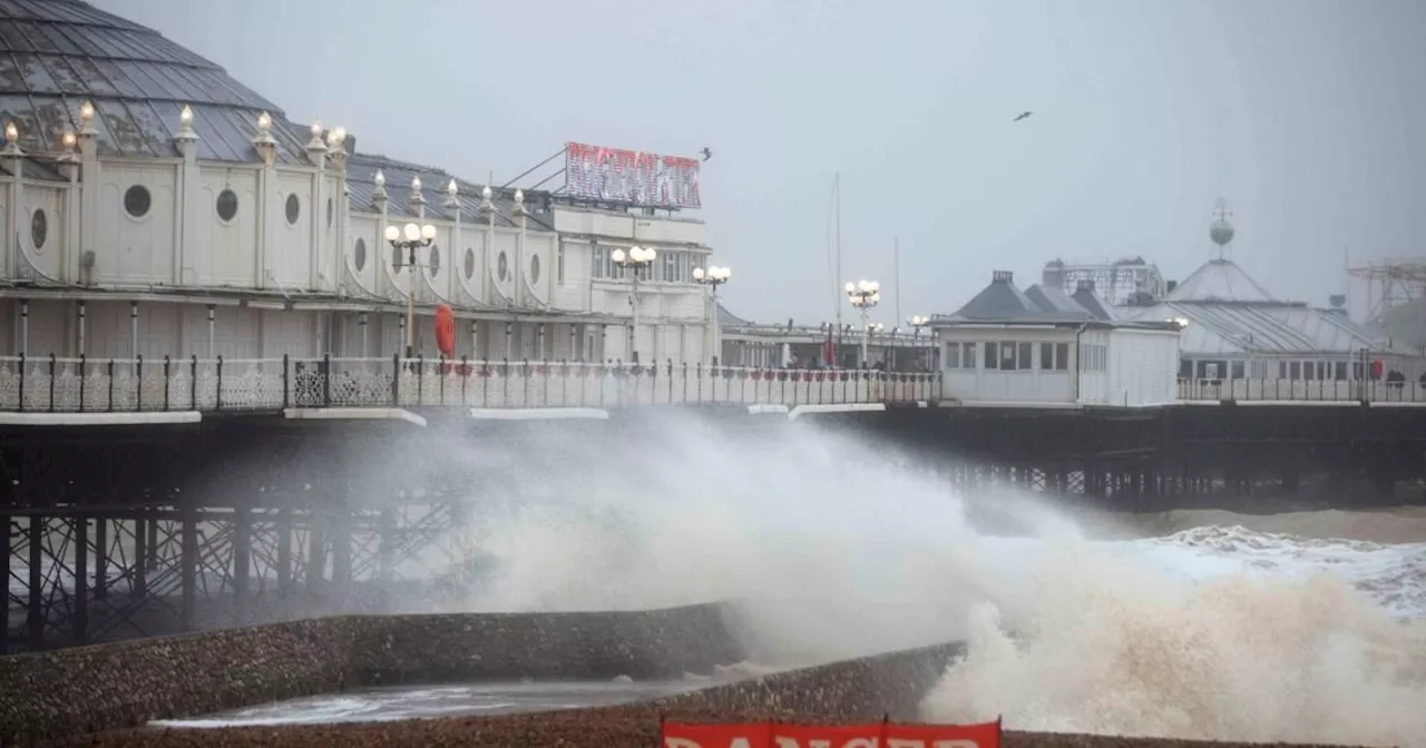
 Lancashire Battened Down as Storm Éowyn Brings 'Danger to Life' WarningThe Met Office has issued a 'danger to life' weather warning for Lancashire as Storm Éowyn is set to lash the UK with winds of up to 90mph and torrential rain. The yellow alert for wind covers the whole county on Friday (January 24) from 12am to 11.59pm. The Met Office warns that flying debris, large waves, and beach material thrown onto seafronts, roads, and properties could lead to injuries and danger to life. Damage to buildings and homes, including roofs blown off and power lines brought down, is also possible. Storm Éowyn is expected to pass close to or across the northwest of the UK on Friday before clearing to the northeast on Saturday.
Read more »
 First named storm of 2025, Storm Eowyn, set to hit UKThe first named storm of 2025, Storm Eowyn, is expected to bring rain and heavy winds to the UK this weekend. This is the fifth named storm of the 2024-25 storm season, following Storms Ashley, Bert, Conall, and Darragh. The Met Office has issued warnings and advises people to be prepared for potential disruptions.
Read more »
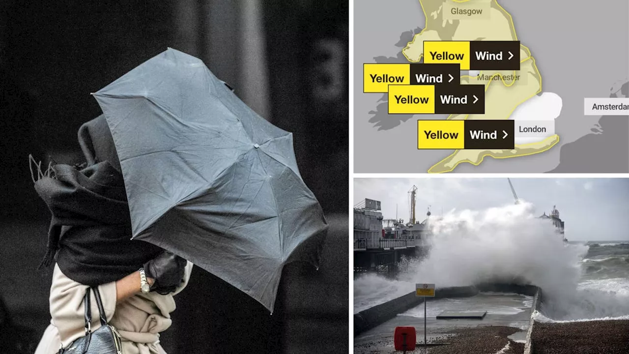
 Storm Éowyn to Bring 80mph Winds and Disruption to UKThe Met Office has named the approaching storm Éowyn, which is set to bring 80mph winds, heavy rainfall, and snow to the UK this Friday. A yellow wind warning has been issued for most of the country, with the potential for damage to buildings, transport disruption, and power cuts. The storm is being fueled by a supercharged Jet Stream caused by a clash of Arctic and tropical air.
Read more »
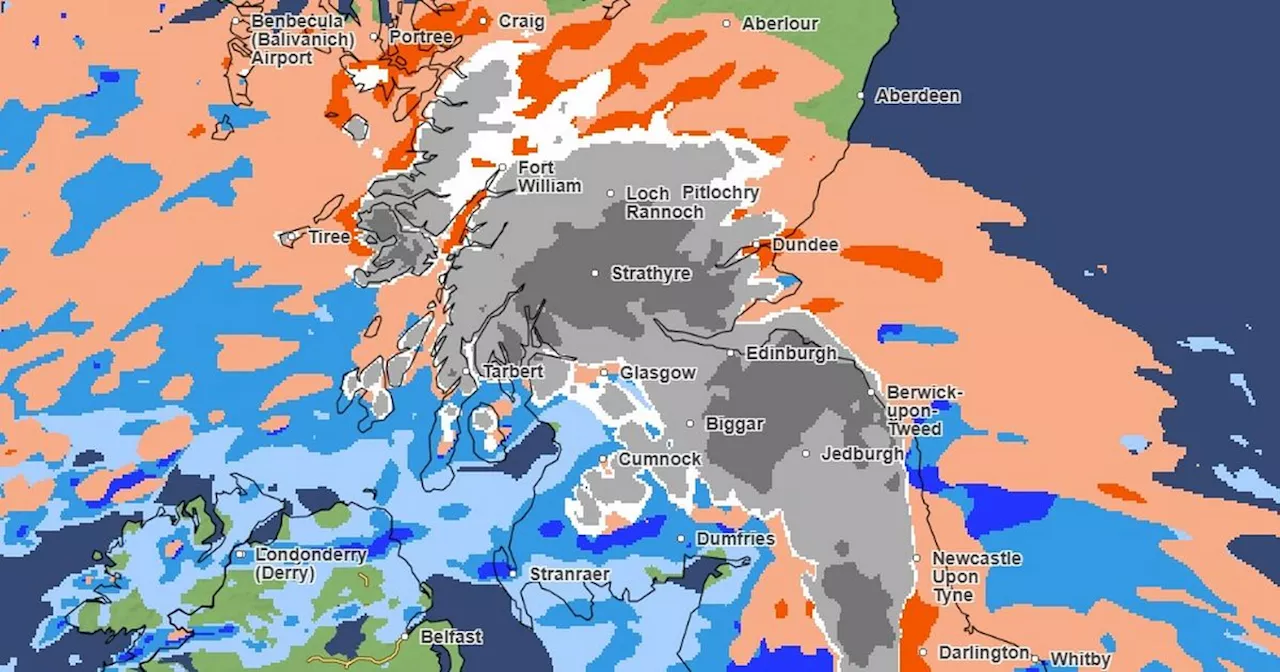 Met Office maps show when and where snow will fall as Storm Éowyn hitsThe UK will see a 'major change' in the weather from Thursday night
Read more »
 Storm Éowyn to Bring Strong Winds and Disruption to Preston on FridayStorm Éowyn is predicted to cause very strong winds and widespread disruption across the UK on Friday, including Preston and the North West. The Met Office has issued a yellow weather warning for wind, advising of potential impacts on public transport, building damage, power outages, and flying debris.
Read more »
 Storm Éowyn to Batter UK with 80mph Winds, Bringing Travel Chaos and Potential DangerThe UK braces for Storm Éowyn, the fifth named storm of the season, which is set to unleash winds of up to 80mph across the country. The Met Office has issued severe weather warnings with potential for building damage, flying debris, power cuts, and travel disruption. Coastal residents are warned of large waves posing a risk to life.
Read more »