New England faces a weekend of snow followed by a sharp plunge in temperatures, with single digits expected in Boston.
New England residents can anticipate several opportunities for snowfall leading up to the weekend, followed by a significant drop in temperatures, with Boston experiencing single-digit lows. A slight breeze will pick up tonight as a gusty southwest wind prevails along the coast, coinciding with the passage of a clipper system.
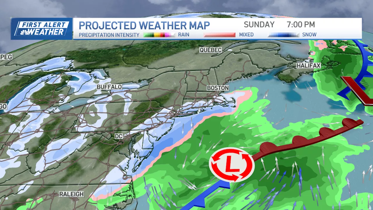
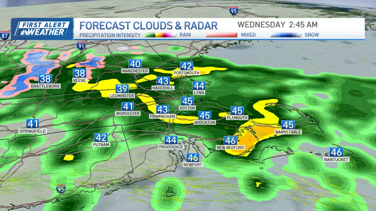
This system will bring a quick-moving chance for flurries or snow showers, resulting in light accumulations overnight and potentially hazardous slick conditions on roads for Friday morning commuters.Scattered coatings to 1 inch of snow are likely across Cape Cod and the Islands through Friday morning. Temperatures will dip to the teens and 20s, increasing the risk of icy conditions. Thankfully, milder air will return for Friday, with seasonable temperatures reaching the mid-30s. Sunny skies will melt away any overnight snow and icy patches, and ice-covered bodies of water will also thaw somewhat, making thin ice potentially dangerous in southern New England.Saturday will see temperatures rise into the 40s as rain showers begin to move in by the late evening. Sunday will commence with colder and dry conditions, but as nighttime approaches, an offshore low-pressure system tracking south of New England will interact with colder air in place following a cold front passage on Saturday. This interaction is expected to bring a few inches of snow across southeastern New England. While the precise track and timing are still uncertain, the indications for snow from Sunday night into early Monday remain strong.Following this snowfall event, a significant influx of arctic air is anticipated, bringing some of the coldest temperatures in two years. Highs are projected to reach the teens for Tuesday and Wednesday, with single-digit temperatures in northern New England
SNOW TEMPERATURE COLD SNAP ARCTIC AIR NEW ENGLAND
United Kingdom Latest News, United Kingdom Headlines
Similar News:You can also read news stories similar to this one that we have collected from other news sources.
 New Year's Eve Rain and Chilly New Year in Store for New EnglandNew Year's Eve will be dry with mild temperatures until midnight when showers begin and last through New Year's Day. A colder air mass moves in Wednesday bringing snow to northern New England. Strong winds expected Thursday combined with snow could cause power outages and damage. Lake-effect and ocean effect snow possible northwest and off the coast, but much of New England will see a dry, sunny, and chilly weekend. A potential storm next week could bring rain and snow to southern New England.
Read more »
 Merseyside Braces for Strong Winds as Heavy Snow Forecast for North of EnglandThe Met Office has issued a yellow weather warning for wind for Merseyside on New Year's Day and January 2, warning of potential disruption to travel and property damage.
Read more »
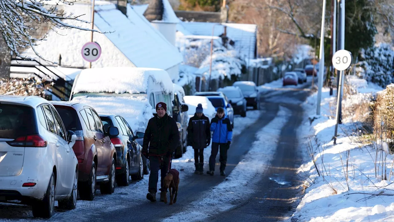
 Snow Warning for Southern England as UK Braces for Coldest NightsA yellow weather warning has been issued for snow in Southern England, with up to 5 centimetres expected. The Met Office also warns of disruption to travel and power cuts. Meanwhile, Scotland and Northern Ireland face further snow and icy conditions.
Read more »
 UK Weekend Snow Forecast: Disruptive Snow Expected Across England, Wales and IrelandForecasters predict snow for much of England, Wales and Ireland this weekend, with the heaviest snowfall expected in northern England. Milder air from the south may limit snowfall in some southern areas.
Read more »
 UK Braces for Snow and Cold Snap on New Year's DayAfter a mild Christmas, the UK is set to experience a significant drop in temperatures and heavy snowfall on New Year's Day, with the heaviest accumulations expected in central and southern England.
Read more »
 Scotland Braces for New Year's Chaos as Heavy Snow and Rain LoomThe Met Office predicts hazardous snow and heavy rain for Scotland, starting on December 30th and lasting through New Year's. A yellow warning for rain has been issued, with potential flooding, power outages, and hazardous driving conditions. Snow is expected to intensify throughout the week, spreading southwards to other parts of the UK.
Read more »