Although periodic rain continues through Thursday, the heaviest of the rain has fallen and very few spots are expected to see any new flooding of low-lying…
Although periodic rain continues through Thursday, the heaviest of the rain has fallen and very few spots are expected to see any new flooding of low-lying areas.
Nearly all river flooding that does occur will be minor, except for Rhode Island's Pawtuxet and Wood Rivers, which should reach moderate flood stage but fall about four feet shy of the serious levels reached in December flooding at the beginning of the winter.Sign up for NECN newsletters. Even as showers ship out and drying ensues Thursday night, the breeze will continue from the north, dragging cooler air southward across New England. Friday, the drier and cooler air will deliver sunshine — and that sun should help temperatures to rise above 50 degrees in the western half of New England while eastern areas are likely to stay cooler, in the 40s.
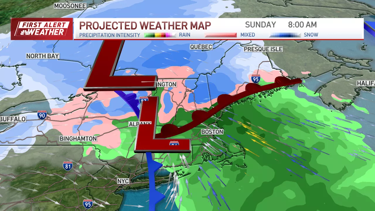
While the storm will redevelop from a position over northern New York State to a position over the western Gulf of Maine, air mild enough to change snow to rain will spread into some of northern New England Saturday overnight into Sunday, though the mountains and higher terrain will likely remain as snow Sunday, with at least some pockets of snow lingering into Sunday night and Monday on favored northwest slopes.
United Kingdom Latest News, United Kingdom Headlines
Similar News:You can also read news stories similar to this one that we have collected from other news sources.
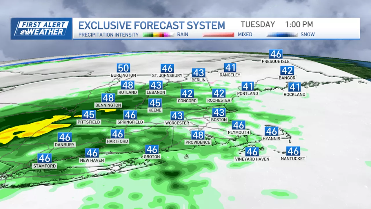 Rainy Weekend Ahead with Low TemperaturesAnother system moves in for this weekend, with rain chances Saturday evening through Sunday and highs in the low 40s. Our east, northeast breeze continues to keep drizzle, low clouds, fog and cool temperatures, especially across the coast and eastern New England giving us a raw feel all day long. More showers fill in through the afternoon to evening commute from southwest to northeast. High temps stay in the low 40s. By Wednesday, our temps warm just a bit to 50s and low 60s, as we see a break in rain and some sunshine as we sit between systems. Wednesday night, we have two systems moving in. One is a weak boundary from the northwest. At the same time, a coastal low moves in from the south. Heavy rain and wind will bring us into Thursday morning and a First Alert day. With so much rain, there is a risk for some flooding in southeastern New England in low-lying areas, around rivers or streams and in urban areas. Drier air returns for Friday briefly with some sun and highs in the 40s again. Although a few ocean-effect snow flurries may be found across Cape Cod.
Read more »
 Snow hits Yorkshire overnight as flood warnings put in place on FridayAccording to the Met Office, it will be another rainy day across Friday
Read more »
 Microsoft to reveal the future of Xbox on ThursdayMicrosoft has announced it will share updates on 'the Xbox business' in a special edition of the Official Xbox Podcast that will air later this week.
Read more »
 Yellow warning of rain and wind issued for Thursday in the EastHeavy showers are forecast across the East of England, while strong gusts are expected on the coast.
Read more »
 Jury to continue deliberations Thursday in Harmony Montgomery murder trialJurors are expected to begin their second day of deliberations Thursday in the murder trial of Adam Montgomery, accused of killing his 5-year-old daughter…
Read more »
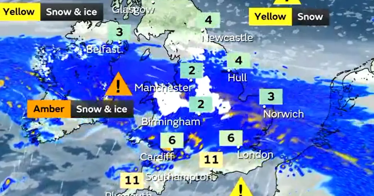 Hour-by-hour forecast for Leeds on Thursday as severe snow warning issuedSnow is forecast to fall in Leeds on Thursday
Read more »